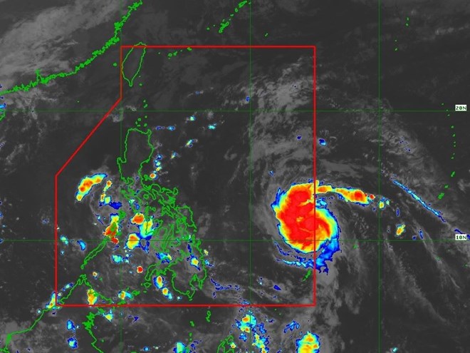
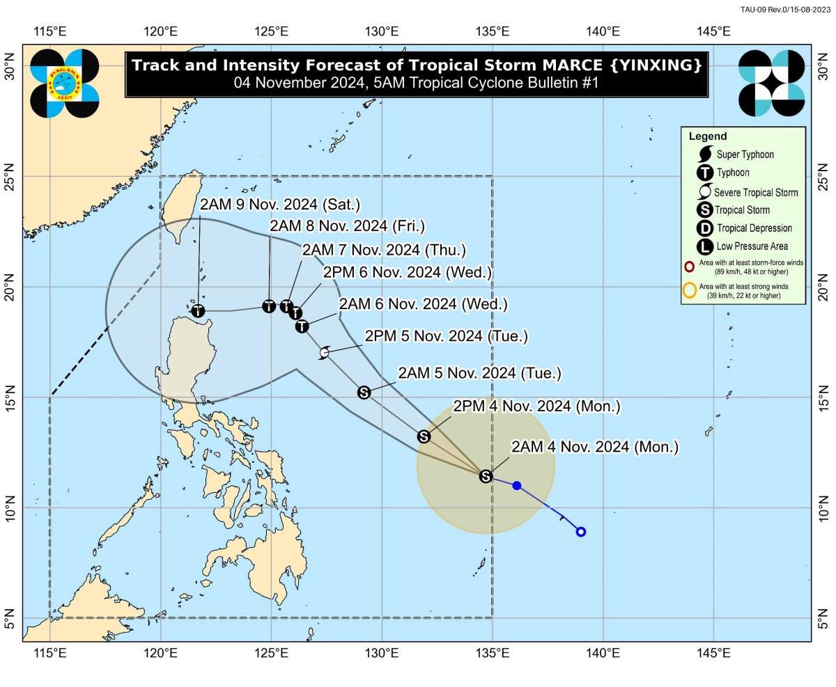
The latest storm update from the Philippine Atmospheric, Geophysical, and Astronomical Services Administration (PAGASA) reports that as of 5:00 a.m. on November 4, the center of tropical storm Marce was located at approximately 11.5°N latitude and 134.3°E longitude, around 935 km east of Eastern Visayas.

The maximum sustained winds near the storm’s center are 65 km/h, with gusts reaching up to 80 km/h and a central pressure of 1002 hPa. Marce is moving west-northwest at 25 km/h, with strong winds extending outward up to 380 km from the storm’s center.
As Typhoon Marce moves northwest within the Philippine Area of Responsibility (PAR), it may strengthen northeasterly winds, bringing rain to Northern Luzon and eastern parts of Luzon starting today or tomorrow, November 5.
Sea conditions over the next 24 hours: Rough seas are expected with waves reaching 3 meters along the coasts of Batanes and Ilocos Norte and up to 2.5 meters along the coastlines of the Babuyan Islands and the eastern coast of mainland Cagayan and Isabela.
Forecast track and intensity: Marce is expected to move west or west-northwest until Wednesday morning (November 6) before significantly slowing down. From Wednesday afternoon until the end of the forecast period, this tropical storm will likely shift north-northwestward at a slower pace over the Philippine Sea east of Northern Luzon.

This forecast remains highly uncertain due to two possible scenarios. First, the typhoon could track further westward towards Northern Luzon or mainland Luzon. Alternatively, the storm may have erratic movement over the Philippine Sea east of Northern Luzon. Consequently, the forecasted track is likely to change in upcoming advisories or bulletins.
The westward path may shift within the next 24 hours, influenced by a high-pressure area north of Typhoon Marce. Therefore, the landfall scenario could vary, possibly affecting areas from the Babuyan Islands down to the Isabela region.
PAGASA predicts that Typhoon Marce is expected to intensify, possibly reaching severe tropical storm status by tomorrow morning or afternoon (November 5). The storm could further strengthen to typhoon status by tomorrow evening (November 5) or early Wednesday morning (November 6).